Monday, October 5, 2015

Part three


Hard to see but the storm clouds were brewing behind the arch. Looks like you can walk to the base, maybe even climb it but I did not want to try and get my truck out of here if it started raining so I didn't stick around. Passed a group of three on the way up, the only others crazy enough to come up the road. Made it back to the truck where a thirsty dog was happy to see it.

 Made it the washout where the other group had parked their Jeep. Unfortunately the approach angle was obscured and I didn't get out and spot myself. I hate hearing that crunching sound but at least I didn't get stuck. Its only noticeable if you squat down.
By this time I was only going to barely have time for lunch before the cave tour. You can certainly see where they won't be repairing the road any time soon. Its going to be a long time before the hillside regenerate.


They never even checked my ticket before the tour. Took me a bit to figure out how to use my camera in a cave. I made the mistake leaving my 55-200 lens on thinking there'd be some large rooms. Unfortunately there are three rooms they don't take you into. I wish there were an option for putting on the caving gear and doing some real spelunking. I'm sure some get to go in the rest of the cave.


After the cave it was time to do the scenic tour up the Mather overlook. Turned out though when I got up there the road was no longer closed so I got to go all the way up. Turns out at 10,000 feet you get some good color.


Unfortunately it was late afternoon and I was shooting into the sun. Back to camp and get ready for an early start. Of course it rains again so I have to load up wet gear. Hit the road before it was light. Finally put those expensive lights to use. Before Ely the rain changes to fog. Good thick stuff. I decided instead of heading back on 50 I'd take 6. Only done the CA portion before so it was all new to me. If you think 50 is lonely you haven't see 6. I wanted to see the Lunar Crater and maybe hit McCann Pass in the Monitor range since it was mentioned in the book and relatively close to highway 6. It rained pretty much the whole way. I started down the dirt road to the crater and even though it felt firm I decided it was too risky in the rain. A closer look at the map and I see the road in the Monitor Range is marked 4x4 and "impassible when wet". Its rained so much the desert is beginning to form lakes.


I barely had enough breaks to get the dog a bit of break and stretch his legs. Went through Hawthorne and took 367 past mono lake to 395. Was a bit worried when I saw 108 closed but Monitor pass was open. I finally saw the sun once I was past Placerville. Oops, better go pop the top and let it dry out before I spend all day writing :)

GBNP Lexington Arch

Almost forgot this pic. Nice nest on the pumphouse,
Back to the Lexington Arch. The pamphlet said the road was recommended for high clearance vehicles. It didn't say anything about the washouts.

I stopped and walked  a bit of the road. Should have stayed here.


From here on it was 4wheel low range through to the next big washout that had a bypass. The bypass was just barely passable. Not long after this I came to the end of the road.
From here I decided to scout the road. Hmmm, passable in the Jeep for a bit, then hmmm, passable in an atv, then hmmm, maybe an expert rider on a trials bike. At least they'd marked the path.

By this time I'd found the end of road and the start of the trail. May as well head on up. More than the quart of water I had would have been good but its only 1.5 miles. Straight up. I followed the switchbacks, Riley added some extra distance. Just in case I didn't make it they were ready for me.
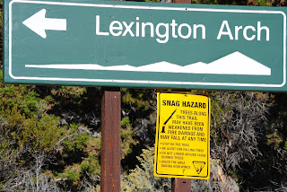
I finally found the arch.


GBNP

Got a late start on Thursday. Made it to Tahoe before we stopped to stretch.
Fueled up in Fallon and then stopped at Grimes Point. Watched the Jets practicing in the inclement weather. I'd forgotten just how loud they are.
Unfortunately the rain made it impossible to make out the petroglyphs before we had to bail as the rain increased.
Interesting old telegraph site.

I don't recommend it but I managed to get a shot of a rainbow while driving :)

Luckily the rain stopped by the time we reached Austin. I opted to head on over to Big Creek CG since by this time I only had an hour of daylight left. It wasn't easy to find but I made it. Its about a fourteen site NF (free too) with not one but two standard outhouses and picnic tables at each site. Only two sites were taken and I took the end one. Huge space suitable for for a dozen rigs. I barely had my camp setup when the rain started.

The skies opened up and we dove inside the camper while the lightning flashed and the winds howled. Its only the second time I've been in wind severe enough to rock the camper. Then (cue ominous music) I see water coming in through the stitching around the window. Oh crap, I'd forgotten the two forward windows had the storm flaps rolled up. The lightning was close, about a count of two and I seriously considered the possibility I could get hit. Nevertheless I jumped out and quickly got the storm flaps down. About an hour later the storm settled down to a nice gentle rain. The the thought occurred to me. How'd Big Creek get its name? Its a pretty small creek. Not that the lightning hadn't freaked me out enough now I'm thinking about flash floods! During a lull in the rain I checked the creek. It had turned brown but no level rise. Besides, the guy with his tent right next to the creek would surely make some noise before it got as high as my camp 

Had coffee and hit the road. No dust raised on the road out now (btw, the highway had signage warning of blow dust just before Austin. On the other side of Austin is another campground right off the road, of course.

Lots of historical markers along Highway 50
Checked out Illipah on the way. Not a place I'd want to do more than overnight at.
Had breakfast at the Hotel in Ely. Fueled up and headed on to Great Basin NP. Along the way I followed to BLM fire engines They weren't code 3 but traveled fast even I (and I don't dawdle) didn't want to pass them. They continued on as I went into the Visitor center. Another couple in a newer FWC pulled up next to me. Sorry I don't remember their names. They were finishing up a two and half week trip and on the way back to bay area. They lurk on WTW, hopefully that'll change and we can get a trip report from them. 

Inside the visitor center were two signs (or was it one sign and a verbal?). The cave tours were full up for the day and there was a fire somewhere up by Wheeler peak and the road was closed at the Mather overlook. Scratch plans A and B. I went on up to the Lehman Caves center and managed to get the last spot on the last tour of the day on Saturday. Then on over to Baker campground where I pleasantly surprised to find it very reasonably priced.

Riley was very impressed with wildlife at the campround
Nice view before the rain began again
It was a close call on whether the rain would put out my campfire.
I'm hiding in the camper with the dog. I had a really nice steak dinner before retiring for the night. Then it got bizarre. Eleven O'Clock at night I feel my feet wet. Hey my sleeping bag is wet. I jump up and hit the lights and begin feeling around for leaks. The vinyl is damp but I can't find any other moisture. Then I check the sleeping bag. Its dry too. I'd just dreamed it. Well better a dream than having an actual leak.


After breakfast the plan is to see the lexington arch, drive up Snake Creek and see the Mather overlook before the cave tour. Turned out to be way too ambitious. Didn't realize I'd have to visit Utah.